Where is Mongolia? Geography, Size, and Location Explained
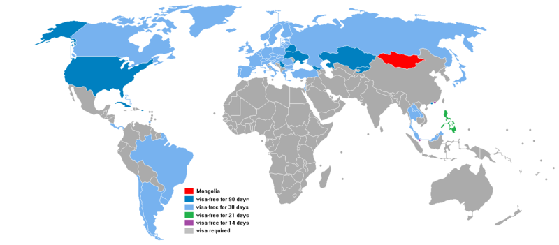
Mongolia is a landlocked country located in East-Central Asia, bordered by Russia to the north and China to the south, east, and west. It covers 1,566,000 km² — the 18th largest country in the world — with a population of approximately 3.4 million (2024). The capital is Ulaanbaatar, located in the north-central part of the country at 48°N latitude.
For many travelers, Mongolia exists at the edge of geographical imagination — known for Genghis Khan, wild horses, and empty steppe, but rarely pinpointed on a mental map with any confidence. In fact, it is one of the largest countries in the world, sitting squarely in the heart of the Asian continent, sandwiched between two giants: Russia and China. And despite its enormous area, it is home to fewer people per square kilometer than almost anywhere on earth. Understanding where Mongolia is — and what that location means for its climate, culture, and character — is the essential starting point for any visit. This guide covers Mongolia's geographic position, its extraordinary physical landscape, its climate, its population, and how it relates to its neighbors and the wider world.
Mongolia occupies a position in East-Central Asia, roughly between latitudes 42°N and 52°N and longitudes 87°E and 120°E. To put this in familiar terms: it sits at roughly the same latitude as southern France or the northern United States, but vastly further inland — at the very heart of the largest landmass on earth. The country shares its entire northern border with Russia (3,485 km) and its entire southern, eastern, and southwestern border with China (4,673 km). These are its only two neighbors — making
Mongolia one of the world's most geopolitically isolated large nations. The nearest ocean coast is approximately 1,500 km away, with the Pacific and Indian Oceans roughly equidistant. Ulaanbaatar, the capital, sits at 47.9°N, 106.9°E — roughly the same longitude as Shanghai and the same latitude as Vienna, though its climate is dramatically more extreme than either. The city stands at an elevation of 1,350 meters above sea level in the Tuul River valley. Mongolia observes two time zones: most of the country runs on UTC+8 (8 hours ahead of GMT, the same as Beijing), while the westernmost provinces use UTC+7.
How large is Mongolia?
Mongolia covers 1,566,000 km² — making it the 18th largest country in the world. To grasp this scale, consider: Mongolia is larger than the United Kingdom, France, Germany, and Spain combined. It is larger than the US state of Alaska. It is almost twice the size of Texas.
It is larger than the US state of Alaska. it is almost twice the size of Texas.
And yet, this vast territory is home to only approximately 3.4 million people — giving Mongolia one of the world's lowest population densities at just 2.2 people per square kilometer. Only Greenland, the Falkland Islands, and a handful of other territories have lower population densities among recognized nations.
What are Mongolia's geographic regions?
Mongolia is far more geographically diverse than its popular image as an endless flat steppe would suggest. The country contains five distinct landscape zones:
What are Mongolia's main geographic features?
Mongolia's physical geography is defined by a set of remarkable features:
Stretching 1,500 km through western Mongolia, the Altai range is the country's dominant mountain system, reaching into Russia to the north and China to the south. Mongolia's highest point — Khuiten Peak (also called Mount Huiten or Nairamdal) — rises to 4,374m on the Chinese border in Tavan Bogd National Park, in the extreme west. Glaciers cover the upper slopes, and clear mountain lakes fill the valleys below.
The Khangai range in central Mongolia is a massive, ancient upland whose highest point is Otgontenger at 4,031m — considered a sacred mountain by Mongolians. The Khentii range in the northeast, reaching 2,800m, is historically significant as the birthplace of Genghis Khan and the source of the Kherlen, Tuul, and Onon rivers.
Mongolia's average elevation is 1,580m above sea level — making it one of the world's highest-altitude countries overall. The lowest point is Huh Nuur (Khukh lake) in Dornod province (far east), at just 560m.
The Selenge River (593 km within Mongolia) is the country's longest river, draining into Russia and ultimately Lake Baikal. The Tuul River flows through Ulaanbaatar. Lake Khuvsgul in the north (136 km long, 262m deep) is the second-largest freshwater lake by volume in Asia and holds approximately 2% of the world's fresh surface water. Uvs Nuur (3,350 km²) is the largest lake by surface area.
What is Mongolia's climate?
Mongolia has an extreme continental climate, characterised by large temperature swings between seasons and between day and night. It is simultaneously one of the sunniest countries on earth (260+ sunny days per year, earning its nickname "Land of Blue Sky") and the location of the world's coldest capital city.
Climate change is increasingly impacting Mongolia's weather patterns, causing more frequent droughts (dzud begins with dry summer reducing grass reserves), more intense zud events in winter, and permafrost thaw in northern regions.
How many people live in Mongolia and where?
Mongolia's population of approximately 3.56 million by July, 2026 is extraordinarily concentrated. Ulaanbaatar alone contains around 1.5 million residents — approximately 45% of the entire national population in a single city. This urbanisation has accelerated dramatically since 1990, when the collapse of the Soviet-era collective system pushed large numbers of rural herders to the capital.
The urban/rural split is now approximately 68% urban and 32% rural or nomadic — though the definition of "nomadic" is fluid, with many families dividing their year between Ulaanbaatar and seasonal pasture. True year-round nomadic herders number around 300,000–400,000.
What countries border Mongolia?
Mongolia has only two land neighbours — an unusually small number for a country of its size. This geographic isolation has shaped Mongolian history, culture, and economy profoundly.
Mongolia declared independence from the Qing Dynasty (China) in 1911 during the Xinhai Revolution. Full international recognition as an independent state came in 1921 following the communist revolution. The Mongolian People's Republic was declared in 1924 under Soviet influence. Mongolia transitioned to a parliamentary democracy in 1990.
Frequently Asked Questions
Is Mongolia part of China?
No — Mongolia is a fully independent sovereign nation with its own government, currency, military, and international representation. It separated from Qing Dynasty China in 1911 and declared full independence in 1921. There is a separate region called Inner Mongolia (Nei Mongol Autonomous Region) which IS part of China, but this is a distinct political entity from the country of Mongolia. The two regions share Mongolian cultural heritage but have been politically separate for over a century.
What is the difference between Mongolia and Inner Mongolia?
Mongolia (the country) is the independent nation of 1,566,000 km² with its capital in Ulaanbaatar, governed by its own parliament and president. Inner Mongolia (Nei Mongol) is an Autonomous Region of the People's Republic of China, covering 1,183,000 km² with its capital in Hohhot. Both have significant Mongolian populations and share elements of cultural heritage, but they have been under separate political administration since the 20th century. The country of Mongolia was historically called "Outer Mongolia" by Qing Dynasty China — a term Mongolians themselves do not use for their own country.
Does Mongolia have access to the sea?
No — Mongolia is one of the world's largest landlocked countries and has no coastline whatsoever. There are no navigable waterways connecting Mongolia to any ocean. International trade relies on Chinese and Russian transport infrastructure, and Mongolian exports (primarily copper, coal, and gold) reach world markets through Chinese ports. This landlocked status is considered one of the significant constraints on Mongolia's economic development.
What ocean is closest to Mongolia?
The Pacific Ocean (specifically the Yellow Sea and Bohai Sea coast of China) is the closest ocean — approximately 1,300–1,500 km east of Mongolia's eastern border. The Arctic Ocean via Russian river systems is roughly 2,000 km north. The Indian Ocean is approximately 2,000 km to the south via China. In every direction, reaching the sea requires crossing at least one other country's entire territory.
Why is Mongolia so sparsely populated?
Several factors combine. The extreme climate — winters of −40°C and a short growing season — makes large-scale conventional agriculture impossible across most of the country. Total cultivated land is only approximately 1,350 km² out of 1,566,000 km² of total area. The traditional nomadic pastoral economy does not support dense settlement and historically discouraged the growth of cities. Urbanisation has accelerated sharply since 1990, and Ulaanbaatar has tripled in population since then, but the vast majority of the country's area remains nearly empty.
What is Mongolia known for worldwide?
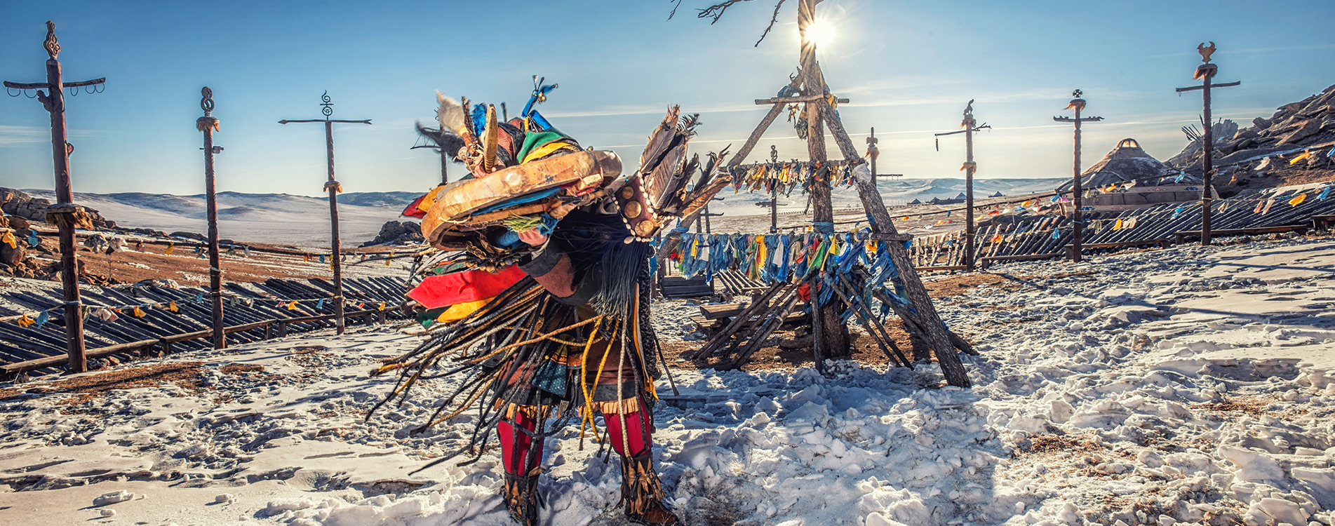
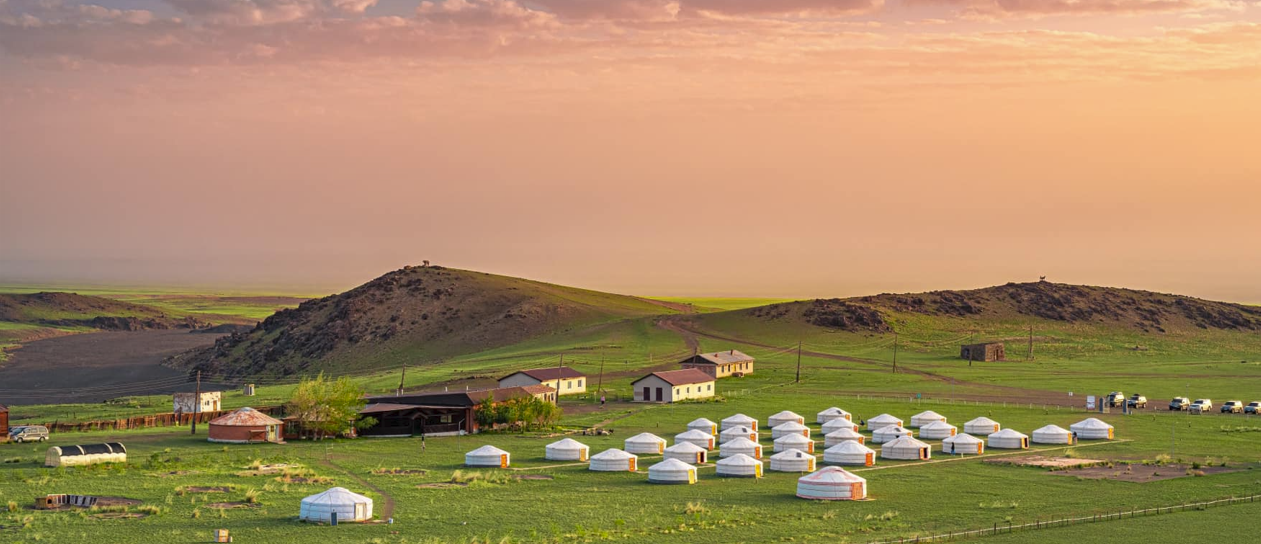
Mongolia is most widely associated internationally with Genghis Khan (born c. 1162) and the Mongol Empire (1206–1368) — the largest contiguous land empire in human history, stretching from Korea to Hungary at its peak. Beyond history: Mongolia is known for its horse culture (Mongolians are regarded as the world's finest horsemen), the Gobi Desert, the Naadam Festival, Kazakh eagle hunters, Buddhist monasteries, nomadic traditions, and exceptional dinosaur fossil finds (the Gobi has produced more dinosaur eggs than anywhere else on earth). It is increasingly known as a destination for adventure travel, wilderness experiences, and sustainable nomadic tourism.
Discover Mongolia has been helping international visitors navigate this vast, extraordinary country since 2004. Whether you want to explore the Gobi Desert, trek the Altai Mountains, witness the Naadam Festival, or simply understand where Mongolia fits in the world — our local team of expert guides is here to show you every side of this extraordinary land.